

Ag Terrane @agterrane@social.cleverlibre.org
#Mostly confused. #Seismology. #Volcanos. #Astrophysics. # Archaeology. #Art. #Interior Design. Most science.
Joined Nov 2022
Ag Terrane
boosted

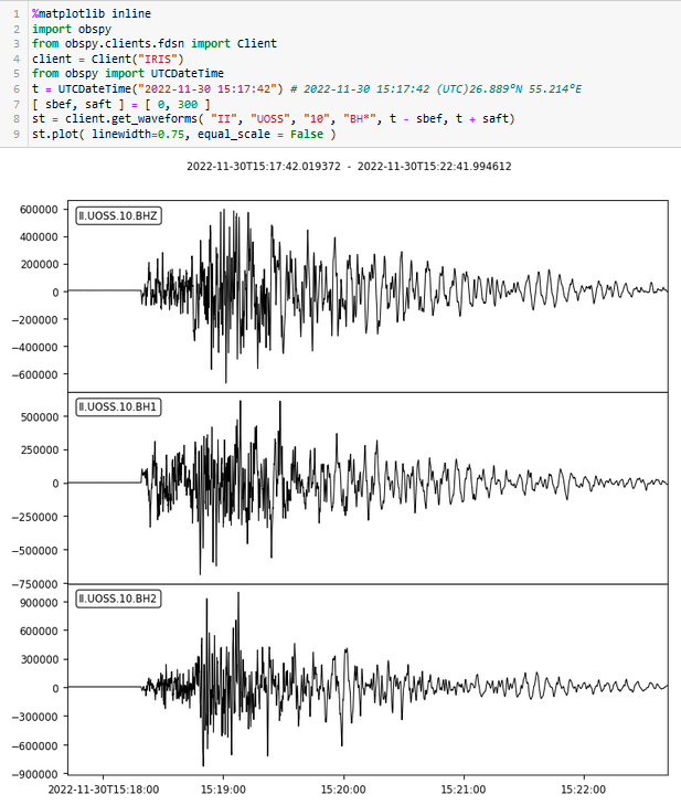
Magnitude 5.6 #earthquake in southern #Iran 45 minutes ago (2022-11-30Z15:17) It is quite shallow so the impact is most likely related to population density in the region. Could be dangerous if vulnerable settlements are hit. Signal on station II.UOSS (University of Sharjah, Sharjah, United Arab Emirates, and obtained directly via IRIS)
https://earthquake.usgs.gov/earthquakes/eventpage/us6000j5sn/executive
Ag Terrane
boosted

I bet octopuses think bones are horrific. I bet all their cosmic horror stories involve rigid-limbs and hinged joints.
Ag Terrane
boosted

Idolising people is never a good idea. Idolising billionaires even less so.
Ag Terrane
boosted
Lava flows cutting Mauna Loa observatory road (photo USGS)
https://www.usgs.gov/media/images/lava-flow-cutting-mauna-loa-observatory-road
Ag Terrane
boosted

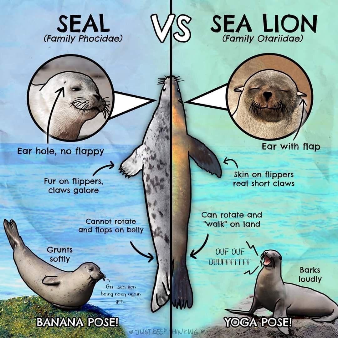
If you’ve ever wondered what the difference is between a seal and a sea lion then HAVE I GOT THE CHART FOR YOU.
Ag Terrane
boosted

Please boost if you’re still masking indoors (in public places)
Ag Terrane
boosted
"La baguette de pain française inscrite au patrimoine immatériel de l’humanité par l’Unesco !" 🥖 😋
Another cold windy day.
The cats sleep in the sun.
Ag Terrane
boosted

Today those police-defunding leftists on the City of San Francisco board of supervisors voted to let cops use robots to kill people by blowing them up.
https://www.sfgate.com/politics/article/San-Francisco-approves-lethal-robots-17619556.php
Ag Terrane
boosted

Ag Terrane
boosted

Wat Mahathat, a temple in Ayutthaya, Thailand with a tree grown over a Buddha statue
Shot on my Xiaomi Mi4i phone camera, circa 2016
#ThickTrunkTuesday
#Thailand #Buddha #Ayutthaya #blackandwhitephotograhy #photograhy
Ag Terrane
boosted

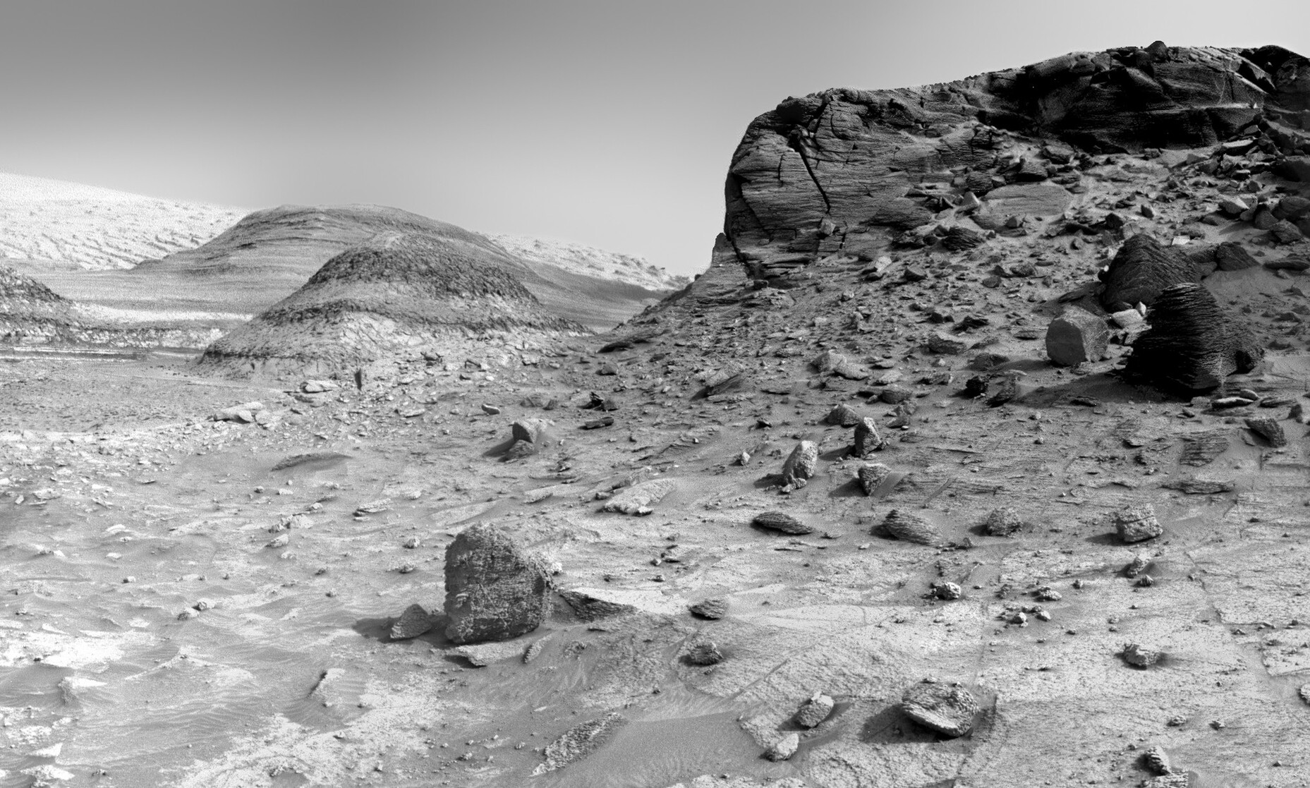
Amazing NavCam image taken yesterday by the Mars Curiosity Rover following a 52 meter drive. The central mound of Gale Crater, Mount Sharp, is visible at left.
NASA/JPL-Caltech/Kevin M. Gill

Ag Terrane
boosted

The USGS #MaunaLoa search page with lots of new photos and maps of the #eruption: https://www.usgs.gov/search?keywords=mauna%20loa
From #Hubble, the sonification of Pismis 24
Ag Terrane
boosted
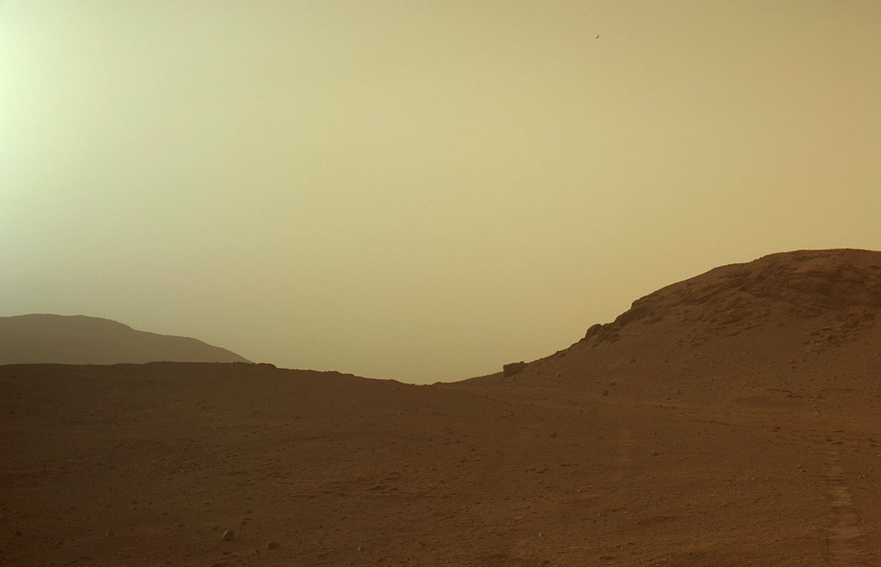
A dusty evening on Mars. I love that we live at a time where we can just see photos from the surfaces of another planet as clearly as if we took them ourselves.
Credit for this one: NASA/JPL-Caltech/S Atkinson
Ag Terrane
boosted

#volcan #volcano #MaunaLoa Une webcam permet de voir la fracture éruptive principale!A webcam shows the main eruptive fracture ! https://www.usgs.gov/media/webcams/m5cam-mauna-loa-fissure-3-eruption-northeast-rift-zone
Ag Terrane
boosted

If you haven’t watched this excellent #USGS time-lapse video of the start of the #MaunaLoa eruption taken from the summit thermal camera, you should: https://www.usgs.gov/media/videos/mauna-loa-eruption-2022-thermal-imagery
Ag Terrane
boosted






As we follow the #MaunaLoaEruption, I want to remind everybody that #volcanoes don’t smoke unless they are on fire. The gray plumes you are seeing are ash or vog (volcanic fog).
Ag Terrane
boosted
Correction: as @culturevolcan pointed out, this is NOT the northeastern rift zone, but the southwestern volcano flank.
Citing: "This picture shows in fact a portion of the initial eruptive fracture cutting the upper South-West flank. Mostly gaz release a a few short lava flows there berfore the magma was drained by the North-East Rift Zone"
Looking carefully to the background you may see the South Pit and two small rounded volcanoes that are located SW of the main caldera.

Another excellent view of the #MaunaLoa upper northeastern rift zone with the active erupting fissure in the foreground. The summit caldera is in t...

#Mostly confused. #Seismology. #Volcanos. #Astrophysics. # Archaeology. #Art. #Interior Design. Most science.
Joined Nov 2022
