
“The worst nightclubs for a durty take away after chucking out time”
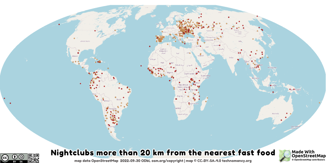
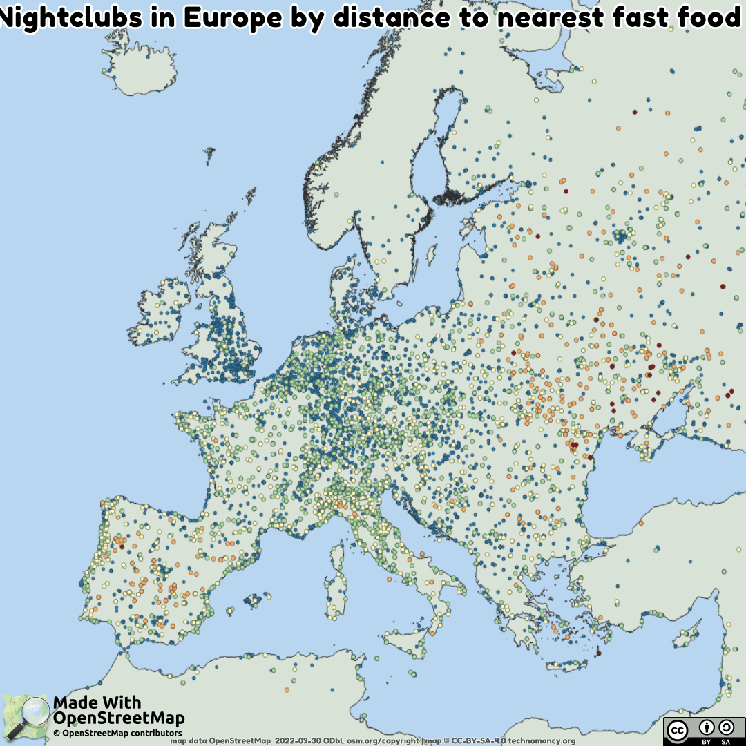
Night Clubs in #OpenStreetMap that are far from Fast Food.
🖼️ https://imgur.com/a/xqS1xQH
🗺️ explore the map: https://geojson.io/#id=gist:amandasaurus/8f40ea450cdcd455b47fa95977d16110
🔢 data: https://gist.github.com/amandasaurus/05cc221eaddc6945d3cc6fa56eff3d76
After you've been out dancing & drinking at the club, that take away joint open at 2am suddenly looks very appealing. Here's a #map of all the nightclubs in #OpenStreetMap marked by how far away they are from the nearest take away.


@rastinza oops sorry. I'm still figuring out QGis.
FYI blue = <1km, green=1→5km, yellow=5→20km orange=20→50km red=≥50km